

Airports / Texas / KHYI
San Marcos Regional Airport.
San Marcos, Texas · 597 ft elevation. 1 charter operator based here.
4.4/5
Google rating
49 ratings
1
Operators based
597
Elevation ft
Google rating
Google reviews
Based operators
FBOs on field
Field elevation
Field standing
15 nm
To the nearest alternate
New Braunfels National Airport (KBAZ), 6 fields within 50 nm.
Overview
San Marcos Regional Airport, listed as KHYI, is a mid-sized airport in San Marcos, Texas. The airport sits 597 feet above sea level. With no scheduled airline service, it caters to private, charter, and general aviation traffic.
The airport anchors local charter capacity, Berry Aviation is based here. When weather or ramp space demands it, nearby options are New Braunfels National Airport (KBAZ, 15 nm), Austin Bergstrom International Airport (AUS, 21 nm), and Randolph Air Force Base (RND, 31 nm). With 3 runways, the longest 6,330-foot paved runway, KHYI can typically accommodate aircraft as large as VIP airliners.
Charter pricing from KHYI depends on aircraft category, positioning distance, and trip timing. In directories and search listings it also appears under San Marcos Municipal. Compare rated operators or run a route through the cost estimator to gauge pricing from San Marcos.
1 FBO serves KHYI. Run one? Become the preferred FBO
Ramp services
FBOs on the field
Berry Aviation
Your FBO? Claim it, freeLocated on the west end of the San Marcos Regional Airport (KHYI), Berry Aviation’s FBO facility offers warm hospitality and exceptional customer service. The San Marcos Regional Airport is conveniently located 30 minutes south of downtown Austin, TX, 20 minutes from Circuit of the Americas (COTA) and provides convenient access toward many Texas Hill Country destinations.
- Fuel
- Hangar
- 6:00 am to 10:00 pm, seven days a week; after-hours by appointment
- Unicom 131.15
- Executive lounge
- Conference room
- Wi-Fi
- Cafe
- Restrooms
- Hangar
- Parking
- Fuel
- +8 more
- Phone
- Website
- Address
Directory data, unpaid. FBOs can take the Preferred slot above.
Field capability
ICAO
KHYI
IATA
n/a
FAA / Local
HYI
Elevation
597 ft
Coordinates
29.8927° N · 97.8630° W
Airspace
D · DeltaClass D, DeltaA control tower runs the immediate airspace. Pilots establish two-way radio contact before entering, typical for busy business-aviation fields.Source: FAA NASR class airspace
Size
Medium
Scheduled svc
No
Elevation vs TX fields
state range 6–4,849 ft
At 597 ft, KHYI sits lower than 55% of the 159 Texas fields on the register.
Runways & aircraft access
3 runways
longest 6,330 ft
- 08/266,330 ft × 100 ftAsphaltLighted
- 13/315,601 ft × 100 ftAsphaltLighted
- 17/355,214 ft × 100 ftAsphaltLighted
Which aircraft can operate here
vs longest paved runway 6,330 ft
KHYI's 6,330 ft paved runway typically supports charter aircraft up to VIP airliners.
- Turboprop3,000 ft
- Light Jet3,500 ft
- Midsize Jet4,500 ft
- Super-Midsize Jet5,000 ft
- Heavy Jet5,500 ft
- VIP Airliner6,000 ft
Class minimums are sea-level planning rules of thumb. A specific aircraft's balanced-field length varies with weight, temperature, and field elevation. Confirm performance with the operator.
Based charter operators1

Access & alternates
Closest alternate fields by great-circle distance, every listing links to its own field brief.
- 15nmKBAZNew Braunfels National AirportNew Braunfels
- 21nmAUSAustin Bergstrom International AirportAustin
- 31nmRNDRandolph Air Force BaseUniversal City
- 38nmSATSan Antonio International AirportSan Antonio
- 46nmSSFStinson Municipal AirportSan Antonio
- 48nmSKFLackland Air Force BaseSan Antonio
Location
Open the full mapKHYI · San Marcos Regional Airport · San Marcos, TX
From the ramp
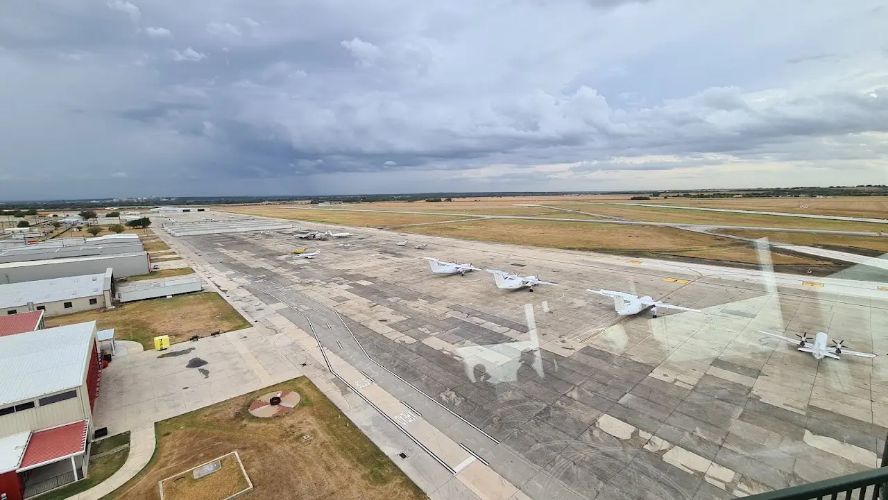
Google Places photography of San Marcos Regional Airport, tap any frame to view full-screen, then cycle with the arrows or your keyboard.
Flight times from here
Approximate nonstop block times from KHYI on a typical midsize charter jet. Faster classes trim these; add positioning and taxi for the real schedule.
| Destination | Distance | Block time |
|---|---|---|
| Houston (HOU) | 136 nm | 43m |
| Dallas (DAL) | 185 nm | 50m |
| Nashville (BNA) | 675 nm | 1h 58m |
| Denver (DEN) | 686 nm | 2h 0m |
| Aspen (ASE) | 715 nm | 2h 4m |
| Vail / Eagle (EGE) | 735 nm | 2h 7m |
| Scottsdale (SCF) | 751 nm | 2h 9m |
| Chicago (ORD) | 871 nm | 2h 26m |
Common questions
- What size private jets can use KHYI?
- San Marcos Regional Airport's longest paved runway is 6,330 ft, which typically supports charter aircraft up to VIP airliners. Lighter classes (turboprops, light and midsize jets) operate comfortably; confirm exact performance for a specific tail with the operator, since balanced-field length shifts with weight, temperature, and elevation.
- What is the longest runway at KHYI?
- San Marcos Regional Airport has 3 runways; the longest measures 6,330 ft on a paved surface and is lit for night operations.
- Are there charter operators based at KHYI?
- Yes. 1 charter operator list San Marcos Regional Airport as a home base, including Berry Aviation. You can also request quotes from operators that reposition aircraft into the field.
- Which FBOs are at San Marcos Regional Airport?
- One FBO serves KHYI: Berry Aviation. Phone, website, hours, unicom and services for each are listed on this page. Call ahead for fuel, ramp space, and ground handling.
- What is the nearest major airport to KHYI?
- The closest alternate is New Braunfels National Airport (KBAZ), about 15 nm away, followed by Austin Bergstrom International Airport (AUS) at 21 nm. Operators often position aircraft between these fields depending on ramp space and availability.
- How long is a flight from KHYI to major cities?
- Typical block times on a midsize jet: Nashville about 1h 58m (675 nm), Denver about 2h 0m (686 nm), Aspen about 2h 4m (715 nm). Faster classes trim these times; add positioning and taxi for the real schedule.