

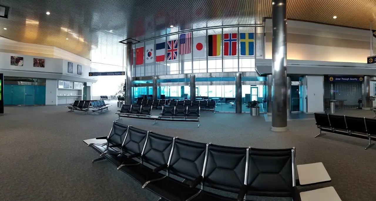
Airports / Washington / MWH
Grant County International Airport.
Moses Lake, Washington · 1,189 ft elevation. A private-aviation gateway on the Bravo register.
4.5/5
Google rating
73 ratings
0
Operators based
1,189
Elevation ft
Google rating
Google reviews
FBOs on field
Field elevation
Nearest alternate
Field standing
38 nm
To the nearest alternate
Pangborn Memorial Airport (EAT).
Overview
Grant County International Airport (KMWH / MWH) sits in Moses Lake, Washington, where it functions as a mid-sized airport. The field lies at an elevation of 1,189 feet. The field has no airline schedules, which keeps it focused on private and general aviation flying.
MWH has no resident charter fleet; trips here are typically flown by operators repositioning from surrounding airports. Useful alternates include Pangborn Memorial Airport (EAT, 38 nm), Tri Cities Airport (PSC, 57 nm), and Yakima Air Terminal McAllister Field (YKM, 63 nm). MWH offers 5 runways, the longest 13,503-foot paved runway, which supports charter types through the VIP airliner class.
Quotes for flights out of MWH vary with aircraft type, repositioning, and schedule flexibility. The airport is also known as LRN and Larson AFB. Use the cost estimator to model a trip from MWH, or browse verified operators serving the area.
2 FBOs serve KMWH. Run one? Become the preferred FBO
Ramp services
FBOs on the field
Columbia Pacific Aviation
Your FBO? Claim it, free- Hangar
- Unicom 122.95
- Hangar
- Maintenance
- Parking
- Ground handling
- Cargo handling
- Phone
- Website
- Address

Million Air Moses Lake
Your FBO? Claim it, freeWith 4,700 acres (19.02 km²) and a main runway 13,500 feet (4,115 m) long, Moses Lake is one of the largest airports in the United States. Moses Lake is famous for good flying weather, as it is located on the east side of the Cascade Mountains, in the semi-arid desert of central Washington State.
- Fuel
- Hangar
- Daily 0600-2200, callout available 24/7
- Unicom 122.95
- Executive lounge
- Customs
- Cafe
- Courtesy car
- Shuttle
- Car rental
- Hotel help
- Hangar
- +13 more
- Phone
- Website
- Address
Directory data, unpaid. FBOs can take the Preferred slot above.
Field capability
ICAO
KMWH
IATA
MWH
FAA / Local
MWH
Elevation
1,189 ft
Coordinates
47.2077° N · 119.3200° W
Airspace
D · DeltaClass D, DeltaA control tower runs the immediate airspace. Pilots establish two-way radio contact before entering, typical for busy business-aviation fields.Source: FAA NASR class airspace
Size
Medium
Scheduled svc
No
Elevation vs WA fields
state range 10–2,556 ft
At 1,189 ft, MWH sits higher than 77% of the 52 Washington fields on the register.
Runways & aircraft access
5 runways
longest 13,503 ft
- 14L/32R13,503 ft × 200 ftAsphaltLighted
- 04/2210,000 ft × 100 ftAsphaltLighted
- 09/273,500 ft × 90 ftConcreteUnlit
- 18/363,327 ft × 75 ftAsphaltLighted
- 14R/32L2,936 ft × 75 ftConcreteUnlit
Which aircraft can operate here
vs longest paved runway 13,503 ft
MWH's 13,503 ft paved runway typically supports charter aircraft up to VIP airliners.
- Turboprop3,000 ft
- Light Jet3,500 ft
- Midsize Jet4,500 ft
- Super-Midsize Jet5,000 ft
- Heavy Jet5,500 ft
- VIP Airliner6,000 ft
Class minimums are sea-level planning rules of thumb. A specific aircraft's balanced-field length varies with weight, temperature, and field elevation. Confirm performance with the operator.
Access & alternates
Closest alternate fields by great-circle distance, every listing links to its own field brief.
- 38nmEATPangborn Memorial AirportWenatchee
- 57nmPSCTri Cities AirportPasco
- 63nmYKMYakima Air Terminal McAllister FieldYakima
- 72nmSKAFairchild Air Force BaseSpokane
- 77nmGEGSpokane International AirportSpokane
- 79nmALWWalla Walla Regional AirportWalla Walla
Location
Open the full mapKMWH · Grant County International Airport · Moses Lake, WA
Flight times from here
Approximate nonstop block times from MWH on a typical midsize charter jet. Faster classes trim these; add positioning and taxi for the real schedule.
| Destination | Distance | Block time |
|---|---|---|
| Seattle (SEA) | 123 nm | 41m |
| Jackson Hole (JAC) | 421 nm | 1h 23m |
| Salt Lake City (SLC) | 499 nm | 1h 34m |
| San Francisco (SFO) | 591 nm | 1h 46m |
| Las Vegas (LAS) | 693 nm | 2h 1m |
| Vail / Eagle (EGE) | 705 nm | 2h 2m |
| Aspen (ASE) | 724 nm | 2h 5m |
| Denver (DEN) | 773 nm | 2h 12m |
Common questions
- What size private jets can use MWH?
- Grant County International Airport's longest paved runway is 13,503 ft, which typically supports charter aircraft up to VIP airliners. Lighter classes (turboprops, light and midsize jets) operate comfortably; confirm exact performance for a specific tail with the operator, since balanced-field length shifts with weight, temperature, and elevation.
- What is the longest runway at MWH?
- Grant County International Airport has 5 runways; the longest measures 13,503 ft on a paved surface and is lit for night operations.
- Which FBOs are at Grant County International Airport?
- 2 FBOs serve MWH: Columbia Pacific Aviation and Million Air Moses Lake. Phone, website, hours, unicom and services for each are listed on this page. Call ahead for fuel, ramp space, and ground handling.
- What is the nearest major airport to MWH?
- The closest alternate is Pangborn Memorial Airport (EAT), about 38 nm away, followed by Tri Cities Airport (PSC) at 57 nm. Operators often position aircraft between these fields depending on ramp space and availability.
- How long is a flight from MWH to major cities?
- Typical block times on a midsize jet: Jackson Hole about 1h 23m (421 nm), Salt Lake City about 1h 34m (499 nm), San Francisco about 1h 46m (591 nm). Faster classes trim these times; add positioning and taxi for the real schedule.