3/ 5 reviews
Easy in & out
“Simple and easy and you can park outside to pick up and drop off .”
Yen Oei5★ on Google


Airports / New York / HPN
White Plains, New York · 439 ft elevation. 6 charter operators based here.
4.0/5
Google rating
2,557 ratings
6
Operators based
439
Elevation ft
Google rating
Google reviews
Based operators
FBOs on field
Field elevation
Field standing
6 operators
Charter fleet based on the field
More resident charter operators than 91% of the 651 US fields with a based fleet on the register.
19 nm
To the nearest alternate
LaGuardia Airport (LGA), 6 fields within 50 nm.
Westchester County Airport, listed as KHPN / HPN, is a mid-sized airport in White Plains, New York. The field lies at an elevation of 439 feet. The airport supports scheduled airline service as well as private jet and charter movements.
Charter departments call it home: Flying Zebra, Melman Aviation, and Panorama Flight Service Inc. base aircraft at HPN, 6 in all. Useful alternates include LaGuardia Airport (LGA, 19 nm), Teterboro Airport (TEB, 21 nm), and Danbury Municipal Airport (DXR, 21 nm). HPN offers 2 runways, the longest 6,549-foot paved runway, which supports charter types through the VIP airliner class.
For arrival logistics and seasonal timing, see the Teterboro, NJ destination guide. The airport is also known as Manhattan and New York City. Use the cost estimator to model a trip from HPN, or browse verified operators serving the area.
5 FBOs serve KHPN. Run one? Become the preferred FBO
Ramp services

Atlantic Aviation Westchester White Plains HPNW
Your FBO? Claim it, freeWestchester County is a great place to visit, or to hold your meeting, event, family reunion or wedding. From the majestic Hudson River to picturesque main streets, world-class shopping to historic homes and gardens, cutting-edge culinary innovation to scenic trails and natural beauty, they’ve got it all.

Atlantic Aviation White Plains
Your FBO? Claim it, freeWestchester County is a great place to visit, or to hold your meeting, event, family reunion or wedding. From the majestic Hudson River to picturesque main streets, world-class shopping to historic homes and gardens, cutting-edge culinary innovation to scenic trails and natural beauty, they’ve got it all.

Million Air White Plains
Your FBO? Claim it, freeMillion Air White Plains is a full-service FBO located at Westchester County Airport, providing convenient access to New York City. Coming soon, a new state-of-the-art FBO facility with the best customer service staff in the Business guaranteed to provide the best experience for you and your guests. We specialize in providing a luxury experience for your flight crews and passengers.

Signature Flight Support Westchester County East Terminal
Your FBO? Claim it, freeA short drive from Manhattan, White Plains boasts a thriving economy and scenic vistas. Considered to be a bedroom community for the greater New York City metropolis, White Plains is also a major corporate destination in its own right. Whatever your ultimate destination, Signature-White Plains can help make the arrangements.

Signature Flight Support Westchester County, West Terminal
Your FBO? Claim it, freeA short drive from Manhattan, White Plains boasts a thriving economy and scenic vistas. Considered to be a bedroom community for the greater New York City metropolis, White Plains is also a major corporate destination in its own right. Whatever your ultimate destination, Signature-White Plains can help make the arrangements.
Directory data, unpaid. FBOs can take the Preferred slot above.
From the stored review texts
3/ 5 reviews
“Simple and easy and you can park outside to pick up and drop off .”
Yen Oei5★ on Google
3/ 5 reviews
“There is a parking garage and the Westchester county police are always present inside and outside the terminal for security.”
William Pataky5★ on Google
Themes counted by keyword across Google review texts for Westchester County Airport, every quote is verbatim from a real review.
ICAO
KHPN
IATA
HPN
FAA / Local
HPN
Elevation
439 ft
Coordinates
41.0670° N · 73.7076° W
Airspace
D · DeltaClass D, DeltaA control tower runs the immediate airspace. Pilots establish two-way radio contact before entering, typical for busy business-aviation fields.Source: FAA NASR class airspace
Size
Medium
Scheduled svc
Yes
Elevation vs NY fields
state range 6–2,135 ft
At 439 ft, HPN sits lower than 50% of the 58 New York fields on the register.
2 runways
longest 6,549 ft
Which aircraft can operate here
vs longest paved runway 6,549 ft
HPN's 6,549 ft paved runway typically supports charter aircraft up to VIP airliners.
Class minimums are sea-level planning rules of thumb. A specific aircraft's balanced-field length varies with weight, temperature, and field elevation. Confirm performance with the operator.


Closest alternate fields by great-circle distance, every listing links to its own field brief.
Destinations served
Location
Open the full mapKHPN · Westchester County Airport · White Plains, NY
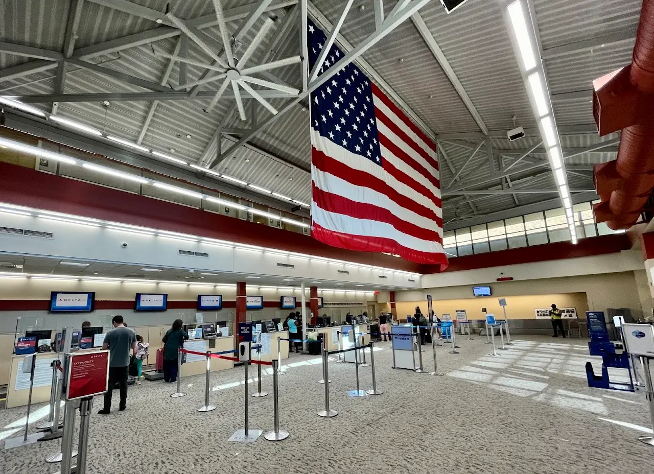
Google Places photography of Westchester County Airport, tap any frame to view full-screen, then cycle with the arrows or your keyboard.
Approximate nonstop block times from HPN on a typical midsize charter jet. Faster classes trim these; add positioning and taxi for the real schedule.
| Destination | Distance | Block time |
|---|---|---|
| Boston (BED) | 137 nm | 43m |
| Washington DC (IAD) | 214 nm | 54m |
| Chicago (ORD) | 640 nm | 1h 53m |
| Nashville (BNA) | 676 nm | 1h 58m |
| Palm Beach (PBI) | 920 nm | 2h 32m |
| Miami (MIA) | 974 nm | 2h 40m |
| Dallas (DAL) | 1,210 nm | 3h 13m |
| Houston (HOU) | 1,254 nm | 3h 19m |
Search operators, brokers, FBOs, airports, aircraft types, manufacturers, destinations and tail numbers