4/ 5 reviews
Easy in & out
“Flying into and out of Indianapolis International Airport (IND) for the first time and it was easy to get around.”
Wendy L5★ on Google


Airports / Indiana / IND
Indianapolis, Indiana · 797 ft elevation. 1 charter operator based here.
4.5/5
Google rating
12,031 ratings
1
Operators based
797
Elevation ft
Google rating
Google reviews
Based operators
FBOs on field
Field elevation
Field standing
33 nm
To the nearest alternate
Columbus Municipal Airport (CLU), 3 fields within 50 nm.
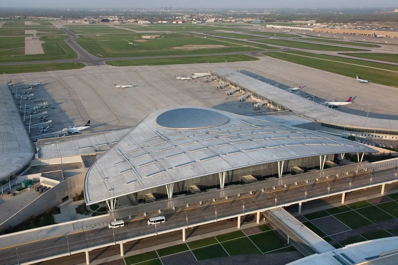
Indianapolis International Airport (KIND / IND) is a large commercial airport serving Indianapolis, Indiana. Field elevation is 797 feet above sea level. Scheduled carriers operate here, and the field also sees regular private and charter activity.
For charter flyers, IND is a home base: Tom Wood Aviation, Inc. operates from the field. The closest alternate fields are Columbus Municipal Airport (CLU, 33 nm), Monroe County Airport (BMG, 37 nm), and Terre Haute Regional Airport, Hulman Field (HUF, 50 nm). The field has 3 runways, the longest 11,200-foot paved runway, long enough for charter aircraft up to VIP airliners.
Charter travelers heading this way can start with the Indianapolis, IN destination guide for route and aircraft recommendations. Browse operators flying from the area or estimate a trip cost from IND to plan your flight.
2 FBOs serve KIND. Run one? Become the preferred FBO
Ramp services

Million Air Indianapolis
Your FBO? Claim it, freeHome of the Indianapolis Colts and Pacers, Indianapolis is best known for hosting the three largest single-day sporting events in the world, The Indy 500 in May, the Brickyard 400 in September and Red Bull Moto GP in August. This home city of the NCAA also frequently hosts Final Four, is the 2020 host of the NCAA college football title game and Big 10 Championship games.

Signature Flight Support Indianapolis
Your FBO? Claim it, freeIndianapolis is best known for hosting the three largest single-day sporting events in the world, the Indy 500 in May, the Brickyard 400 in July and Red Bull Moto GP in August. This Midwestern city is a hotbed for industries ranging from retail to manufacturing. According to a recent report, Indianapolis outpaced the industrial Midwest in spawning start-up businesses.
Directory data, unpaid. FBOs can take the Preferred slot above.
From the stored review texts
4/ 5 reviews
“Flying into and out of Indianapolis International Airport (IND) for the first time and it was easy to get around.”
Wendy L5★ on Google
4/ 5 reviews
“Since the car rental facilities are also located in the main building, the walk to and from your rental car is pleasantly short.”
Florian M.5★ on Google
Themes counted by keyword across Google review texts for Indianapolis International Airport, every quote is verbatim from a real review.
ICAO
KIND
IATA
IND
FAA / Local
IND
Elevation
797 ft
Coordinates
39.7173° N · 86.2944° W
Airspace
C · CharlieClass C, CharlieRadar-controlled airspace around mid-size hubs. Aircraft must be in two-way radio contact and squawking a transponder while approach control sequences arrivals.Source: FAA NASR class airspace
Size
Large
Scheduled svc
Yes
Elevation vs IN fields
state range 387–1,140 ft
At 797 ft, IND sits lower than 55% of the 53 Indiana fields on the register.
3 runways
longest 11,200 ft
Which aircraft can operate here
vs longest paved runway 11,200 ft
IND's 11,200 ft paved runway typically supports charter aircraft up to VIP airliners.
Class minimums are sea-level planning rules of thumb. A specific aircraft's balanced-field length varies with weight, temperature, and field elevation. Confirm performance with the operator.
Closest alternate fields by great-circle distance, every listing links to its own field brief.
Destinations served
Location
Open the full mapKIND · Indianapolis International Airport · Indianapolis, IN
Google Places photography of Indianapolis International Airport, tap any frame to view full-screen, then cycle with the arrows or your keyboard.
Approximate nonstop block times from IND on a typical midsize charter jet. Faster classes trim these; add positioning and taxi for the real schedule.
| Destination | Distance | Block time |
|---|---|---|
| Chicago (ORD) | 154 nm | 45m |
| Nashville (BNA) | 216 nm | 54m |
| Washington DC (IAD) | 413 nm | 1h 22m |
| New York (TEB) | 564 nm | 1h 43m |
| Dallas (DAL) | 656 nm | 1h 56m |
| Boston (BED) | 698 nm | 2h 1m |
| Houston (HOU) | 749 nm | 2h 9m |
| Austin (AUS) | 798 nm | 2h 15m |
Search operators, brokers, FBOs, airports, aircraft types, manufacturers, destinations and tail numbers